
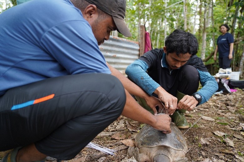
Photo: A researcher from IPB University attaches a GPS tracker to a pig-nosed turtle.
BOVEN DIGOEL — For turtles, movement is far more than mere locomotion. It is driven by critical life-history necessities, such as locating nesting sites, finding mates, migrating, or seeking safer and more suitable microhabitats.
Such granular details regarding animal movement hold immense value. They enable researchers to design targeted conservation strategies that ensure wildlife retains sufficient living space while remaining protected from anthropogenic threats.
One of the primary technological instruments utilized to track animal movements is GPS tracking. While historical methodologies relied heavily on constrained VHF radiotelemetry, modern GPS technology offers vastly superior advantages.
With GPS, spatial data acquisition is significantly more accurate and voluminous, and under specific configurations, data can be transmitted in real-time. This capability allows researchers to make timely empirical decisions without the necessity of continuously shadowing the subject in the field.
However, commercial wildlife GPS telemetry units are cost-prohibitive, typically ranging between IDR 30 to 120 million per unit, excluding shipping fees and import tariffs. For ecological research conducted in Indonesia, such exorbitant costs present a formidable barrier. If financial constraints limit tracking to only one or two specimens, the resulting dataset remains insufficient to accurately characterize population-level ecology.
Local Solution: Cost-Effective GPS Tracker
Amidst the high cost of commercial tracking devices, a collaborative research team from Tunas Sawa Erma (TSE) Group and IPB University devised a cost-effective alternative by engineering their own custom GPS tracker. Their resourceful approach involved modifying existing GPS loggers and integrating a Long Range (LoRa) transmitter. Consequently, the resulting device is not only significantly more affordable but also tailored specifically to the physiological and behavioral requirements of pig-nosed turtles.
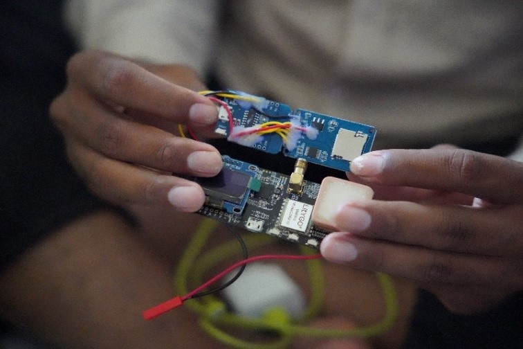
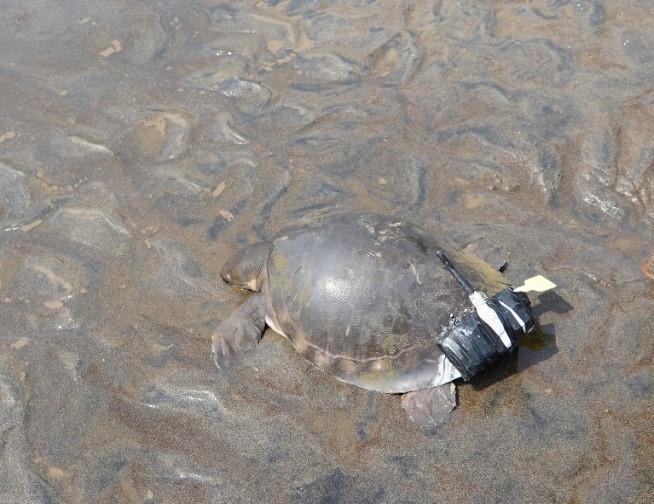
Photo: GPS trackers assist researchers in determining animal movement patterns, activity timing, and spatial utilization, which are fundamental to understanding their survival strategies.
Naturally, strict methodological parameters must be observed. The weight of the tracking unit must not exceed 5–10% of the subject’s total body mass to prevent behavioral disruption. Accordingly, 300-gram units were deployed exclusively on turtles weighing a minimum of 3 kilograms. This precaution ensures that the specimens retain their swimming proficiency, foraging efficiency, and unhindered mobility.
Nonetheless, the deployed GPS tracking system requires further technological optimization. In the Kao River, the LoRa GPS units deployed on the pig-nosed turtles exhibited a operational lifespan of approximately four days. This limitation was primarily attributed to elevated river temperatures affecting battery performance, compounded by high-frequency data logging intervals that maintained continuous signal transmission. Consequently, battery depletion occurred rapidly, restricting the volume of harvested data.
Despite these technical challenges, the modified GPS trackers yielded highly promising outcomes. The devices successfully recorded coordinate points and transmitted data to the receiver, although signal range remained constrained: performance was stable within a 10–30 meter radius, but experienced frequent packet loss at ranges of 40–100 meters, particularly when obstructed by dense riparian vegetation or structures.
These empirical observations provide invaluable insights for subsequent hardware iterations. Future developments will focus on antenna design refinement, strategic placement optimization, and rigorous field testing within natural habitats to accurately quantify operational performance.
Notwithstanding its current limitations, this modified GPS tracking prototype validates a vital premise: cost-effective technology can serve as a viable, real-world solution. By reducing financial barriers, a larger sample size of wildlife can be monitored, yielding broader datasets encompassing migratory pathways, home ranges, and habitat preferences. All of this empirical information serves as an essential foundation for formulating evidence-based conservation strategies.
Ultimately, the efficacy of GPS technology relies less on sheer sophistication and more on its accessibility and large-scale utility. Simple innovations of this nature empower Indonesia to achieve greater self-sufficiency in wildlife research—providing cost-efficient, highly accessible instruments that maintain rigorous data quality standards. (ESG)
